Despachos
ENVIOS TODOS LOS DIAS
HASTA LAS 13 HRS.
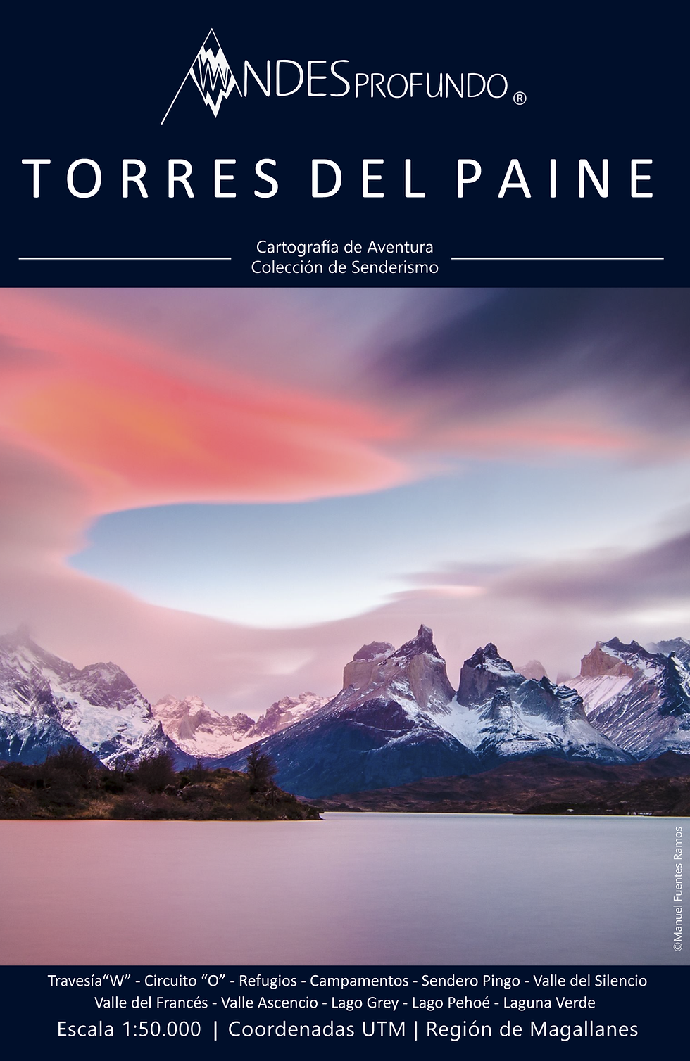
BUSCA TU MAPA
Trekking Collection
senderismo
Essential when planning all Adventure.
Enfocado para el caminante, carreras de aventura y potenciar el turismo local de intereses especiales como el trekking.
Esta coleccion te entrega un mapa sumamente extenso GRANDE, con excelentes detalles de relieve, por lo general para realizar en jornadas sobre cinco días.. Te entregamos un mapa que te inspirara a la exploración de nuestra tierra.
cartografia clasica
Sabemos que muchas veces leer un mapa se vuelve engorroso, es por eso que simplificamos la información para obtener la precisión que necesitas en cualquier momento.
Situaciones en donde el cansancio o el mal clima son factores que contribuyen a errores de interpretación.
Simplificamos la información que realmente necesitarás.
y te mostramos como funciona...
a map
designed
for
you
adventure
Distancias en Sendero
Todo en kilómetros
UTM coordinates
Points of Interest
no calculations
All important points of interest within the map will indicate UTM Coordinates to be entered directly into your Gps navigator without unnecessary calculations
The trails have distance marks in Kilometers so that you can calculate according to your pace and physical condition how long it will take to reach your destination.
Relieve y Sombreado
Interpretación rápida del terreno
Altimetría
Curvas de nivel
cada 25 y 100 metros
details that make a difference
We want to show our mountain range like never before, we did not draw inspiration from the famous Swiss cartographer Eduard Imhoff to obtain a spectacular result in relief and topographic terrain shadows . As a result, you will be able to interpret important gorges and hills much easier.
Altimetry and contour lines with high standard, every 25 meters you will be able to visualize all the topographic accidents of the map, also every 100 meters we have a height indicator on all our maps.
Bosque
Límite real de bosque y vegetación
Senderos
Dos tipos de clasificación de senderos Montaña y Trekking
Glaciares
Zonas de Peligro
ROUTE CLASSIFICATION
AND
VEGETATION indicator
Within these maps of great extensions such as those of Trekking, we include two classifications of trails, Mountain Route and Trekking Route .
In order to show users where there is demarcation and frequent maintenance as well as where equipment and technical knowledge a little more advanced will be needed .
All the AndesProfundo maps contain fully updated information on the
existing forest line obtained directly from satellite images.
Grandes Extensiones
Senderos para más de 7 días
Impermeable
Papel Stonepaper Resistente
The Trekking maps collection are of a scale
1: 50.000 ideal for trekking for many many days, especially for complete crossings, without sacrificing topographic detail of the terrain
A MAP
DURABLE
WATERPROOF
ecological
Printed on StonePaper, paper of mineral origin based on Calcium Carbonate (60 to 80%) and non-toxic high-density polyethylene resin, does not use any tree in its production in addition to a water reduction of almost 90%. This paper also has the properties of being waterproof, resistant to abrasion and degradable to the sun in just 6 months .
Norte
Tres tipos diferentes
Declinación Magnetica
Calculos actualizados
Information on where the main buildings that can serve as a refuge, meeting point or trail starts are located in UTM coordinates , all applicable with a Gps navigator or from your cell phone.
For classic navegation or adventure racing the Compass It is the most precise instrument to locate the magnetic north and orient our map, it contains declination fully updated to the month and year of the map edition.
gps
navigation
& updated
compass

inspire
EXPLORE
THE ANDES
#CARTOGRAFIADEAVENTURA
available
Maps
We have 7 different trekking maps